
Find Property Lines? Expert Tips & Tools
How to Find Property Lines: Expert Tips & Tools for Homeowners
Understanding your property boundaries is essential for any homeowner planning renovations, fence installations, or landscaping projects. Property lines define the legal limits of your land ownership and prevent disputes with neighbors. Whether you’re building a deck, planting trees, or simply curious about your property’s exact dimensions, knowing how to find property lines can save you thousands in potential legal fees and costly mistakes.
Property lines aren’t always obvious from the ground. They may not align with visible fences, driveways, or natural features on your land. In this comprehensive guide, we’ll walk you through multiple methods—from free online resources to professional surveying—to help you accurately locate your property boundaries.
Understanding Property Lines and Deeds
Your property lines are the legal boundaries established when your property was originally surveyed and recorded with local government authorities. These boundaries are documented in your property deed—a legal document that proves ownership and outlines the exact dimensions of your land. The deed typically includes descriptions, metes and bounds measurements, or references to a recorded survey plat.
Every property in the United States is part of a larger surveying system. Most properties are described using one of three methods: the rectangular survey system (township, range, and section), metes and bounds (detailed directional and distance measurements), or lot and block descriptions (common in subdivisions). Understanding which system applies to your property helps you interpret the information you find.
Your property documentation should be kept in a safe location. If you’ve lost your deed, most county assessor offices maintain copies of recorded documents that you can request. The deed is your first stop when learning where your property boundaries actually are.

Free Online Tools to Find Property Lines
The internet offers several free resources to help homeowners identify their property lines without spending hundreds on professional surveys. These tools provide a good starting point and can help you visualize your property’s approximate boundaries.
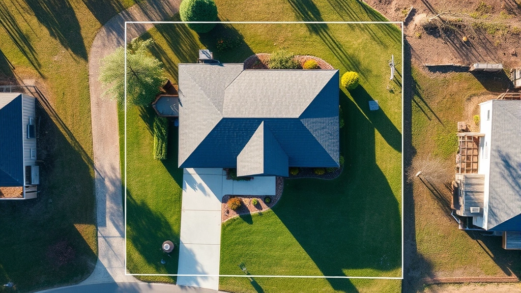
Google Maps and Google Earth allow you to view aerial imagery of your property. While not officially accurate for legal purposes, these platforms can show you general property shapes and help identify visible landmarks. Zoom in on your address and look for property line indicators—some areas display property boundaries as overlay lines.
County Assessor Websites often provide free parcel maps and property information. Search your county assessor’s office online (usually “[County Name] Assessor”) to access GIS (Geographic Information System) maps showing property parcels, dimensions, and sometimes recorded survey information. This data is public record and completely free.
Zillow and Realtor.com display property boundaries on their maps. While primarily real estate listing sites, these platforms show parcel outlines that can help you understand your property’s general shape and size. The information comes from public records and can be surprisingly accurate.
OpenStreetMap and Mapbox are community-driven mapping platforms that sometimes include property line data. These open-source alternatives to Google Maps may have detailed boundary information depending on your area’s data availability.
Many states now offer free online GIS portals where you can search properties by address or parcel number. These state-level resources provide official property information and are often more detailed than county-level systems.
County Records and Public Documents
Your county recorder’s office and assessor’s office maintain comprehensive records of all property transactions and surveys in your area. These public documents are your most reliable free source for property line information.
Visit Your County Recorder’s Office to request copies of your property’s recorded documents. Bring your address or parcel number. Staff can provide copies of your deed, any recorded surveys, and historical property documents. Many counties now offer online search capabilities where you can view these documents from home.
Request a Property Survey Plat if one has been recorded. A plat is a detailed map showing property boundaries, measurements, and sometimes physical features. If a professional survey was ever conducted on your property, it should be recorded with the county and available for a small fee (usually $5-25).
Check the Assessor’s Parcel Number (APN) on your property tax bill or deed. This unique identifier helps you locate your exact property in county databases. Using your APN, you can access detailed property information including lot dimensions, acreage, and recorded boundaries.
Review Historical Documents if your property has changed hands multiple times. Older deeds may contain survey descriptions or reference monuments that help establish original boundaries. These historical records can be especially useful if disputes arise or if original markers have been lost.
County offices typically charge small fees for copies (usually under $1 per page) and provide results within days. Some counties offer online ordering, allowing you to request and receive documents electronically.
Professional Land Survey Methods
When you need legally binding, accurate property line information, a professional land surveyor is your best option. While more expensive than free methods, a survey provides official documentation accepted in court and by government agencies.
Hiring a Licensed Land Surveyor is the gold standard for property line identification. Professional surveyors use specialized equipment (theodolites, GPS units, and measuring chains) to precisely locate property corners and boundaries. They research historical records, locate existing monuments, and create official survey documents.
A typical property survey costs between $300-$1,000 depending on property size, accessibility, and complexity. Urban residential properties are usually less expensive than rural land. Your surveyor will provide a detailed plat showing exact measurements, boundary lines, and the locations of any easements or encroachments.
Types of Surveys Available include boundary surveys (showing property lines), mortgage surveys (required by lenders), and ALTA surveys (detailed surveys for commercial properties). For residential properties, a standard boundary survey is usually sufficient.
Finding a Qualified Surveyor is straightforward. Search your state’s surveyor licensing board or ask your county assessor for recommendations. Professional organizations like the National Society of Professional Surveyors maintain directories of licensed professionals. Always verify licensing and request references before hiring.
Your surveyor will research your property’s history, locate existing boundary markers (called monuments), and establish new markers if needed. They’ll provide you with an official survey document that you can use for construction permits, property disputes, or future reference.
Using GPS and Mapping Technology
Modern GPS technology and smartphone applications have made it easier for homeowners to explore property boundaries, though these tools are supplementary rather than definitive.
Smartphone GPS Applications like Maps, Property Marker, and Boundary Line Finder use your phone’s GPS to show approximate property locations. While convenient, smartphone GPS accuracy is typically only within 15-30 feet—insufficient for precise boundary work but helpful for general orientation.
Handheld GPS Units offer better accuracy (within 5-10 feet) than smartphones. If you own a recreational GPS unit, you can mark the approximate corners of your property and create a basic map. However, this method still isn’t accurate enough for legal or construction purposes.
Drone Aerial Photography can provide helpful visual context for understanding your property’s shape and relationship to surrounding land. Some property owners use drones to create orthographic images that help visualize boundary locations, though these images must be combined with other methods for accurate results.
GIS Web Mapping Tools offered by many counties allow you to layer different information—property boundaries, tax assessor data, flood zones, and zoning information—to create a comprehensive understanding of your property. These tools are often surprisingly detailed and free to use.
Technology is most useful when combined with official records. Use GPS and mapping tools to gather information, then verify findings with recorded documents and professional surveys when necessary.
Physical Markers and Boundary Evidence
Property boundaries are often marked with physical monuments—permanent markers placed by surveyors to indicate corners and lines. Learning to identify these markers helps you understand where your property actually begins and ends.
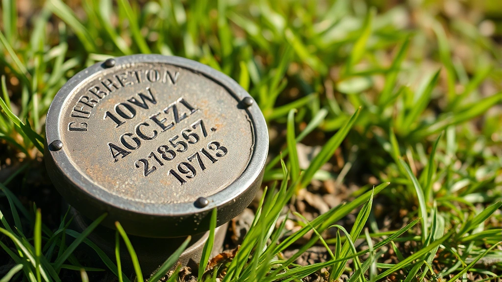
Common Boundary Markers include iron rods (the most common modern marker), concrete monuments, stone markers, and wooden stakes. Iron rods are typically 1-2 inches in diameter and may have a cap identifying the surveyor or date installed. These markers are usually found at property corners and along the property line at regular intervals.
Searching for Existing Monuments requires careful observation. Walk your property boundaries looking for small metal caps, stones, or rods at ground level. Use a metal detector to locate buried iron monuments—many old markers are partially or completely underground. Mark any monuments you find with flags or paint to make them more visible.
Natural Boundary Features sometimes serve as property lines. Rivers, streams, roads, and ridgelines are often used as boundary descriptions. However, these features can shift over time (especially water features), so they must be confirmed against recorded documents.
Fences and Hedgerows are frequently mistaken for property lines but often don’t align with actual boundaries. A fence may be entirely on your property, entirely on your neighbor’s property, or shared. Never assume a fence marks your property line without confirming through official records.
Creating a Boundary Map by marking existing monuments and features helps you visualize your property’s actual extent. Photograph and measure the distance between monuments, then compare your findings to recorded survey documents. This process often reveals discrepancies worth investigating.
Common Mistakes to Avoid
Homeowners frequently make costly errors when trying to identify property lines. Understanding these mistakes helps you approach the task correctly and avoid legal complications.
Assuming Fences Mark Boundaries is the most common error. Fences are often installed for convenience rather than accuracy and frequently encroach on neighboring properties or fall short of actual lines. Always verify through official records before relying on fence locations.
Relying Solely on GPS Coordinates without confirming through recorded documents can lead to incorrect conclusions. GPS has inherent accuracy limitations and shouldn’t be used as your only source of boundary information.
Ignoring Easements and Rights-of-Way is another frequent mistake. Your property deed may include easements allowing utilities, neighbors, or the public to access portions of your land. These restrictions don’t affect ownership but significantly impact land use.
Failing to Research Property History can cause problems with older properties. Previous surveys, boundary agreements, or adverse possession situations may affect your property’s actual boundaries. Historical research prevents surprises later.
Not Getting Professional Surveys Before Construction is a costly error. Building structures on disputed or incorrect property lines can result in forced removal or expensive legal settlements. Always confirm boundaries before significant construction or improvements.
Assuming Online Maps Are Legally Accurate leads many homeowners astray. While Google Maps and county GIS systems are helpful, they’re not official legal documents. Only recorded surveys and deeds provide legally binding boundary information.
The best approach combines multiple methods: research official records, review any existing surveys, observe physical markers, and consult with professionals when making important decisions about your property.
FAQ
How much does a professional property survey cost?
Professional land surveys typically cost between $300-$1,000 for residential properties. Prices vary based on property size, location complexity, and whether the surveyor must locate buried monuments. Rural properties and those with unclear boundaries cost more. Request quotes from multiple surveyors to compare pricing.
Can I find my property lines without hiring a surveyor?
Yes, you can use free resources like county assessor websites, public records, Google Maps, and GIS tools to identify approximate property lines. However, these methods aren’t legally binding. For legal certainty or construction purposes, hire a professional surveyor.
What’s the difference between a deed and a survey?
A deed is a legal document proving ownership and describing your property’s boundaries in text form. A survey is a detailed map created by a professional showing exact measurements and boundary locations. Both are important—the deed establishes ownership while the survey shows precise boundaries.
How do I access my county’s property records online?
Search “[Your County Name] assessor” or “[Your County Name] recorder” to find the official website. Most counties offer online GIS maps where you can search by address or parcel number. Some counties require visiting in person, but most now offer online access to public records.
What if I find my property lines don’t match my deed description?
Discrepancies between your understanding and recorded documents require professional investigation. Hire a land surveyor to research the issue. Boundary disputes can be complex, and professional guidance helps resolve them correctly and legally.
Are property line markers permanent?
Professional monuments are designed to be permanent, but they can be lost, moved, or destroyed over time. If you can’t locate existing markers, a surveyor can re-establish them based on recorded documents. This is an important reason to have professional surveys conducted before major construction.
Can neighbors dispute property lines?
Yes, boundary disputes can arise, especially when property lines are unclear or when one neighbor claims long-term use of disputed land (adverse possession). Professional surveys and recorded documents help resolve disputes, but legal action may be necessary in contested situations. Consult an attorney if disputes arise with neighbors.
Do I need a survey before building a fence?
It’s highly recommended. Many jurisdictions require property line verification before fence installation. Even where not required, confirming boundaries prevents expensive disputes with neighbors. A professional survey ensures your fence is entirely on your property.
What information do I need to find my property on county maps?
You’ll need either your street address or your Assessor’s Parcel Number (APN). The APN appears on your property tax bill and deed. With either piece of information, you can access most county online GIS systems to view your property details and boundaries.
Related Posts

Superscript in Google Docs: Expert Tips

Strikethrough in Excel: Easy Steps for Beginners
